
Troughs and Ridges: The Hidden Drivers of Weather
Bill - The Wx Learner - October 11, 2025
Learn how upper-air features called troughs and ridges control storm tracks, temperature swings, and the patterns that define our daily weather.
If you’ve ever wondered why one week is all sunshine and the next brings nonstop storms, the answer’s high above us, in the fast-moving air that circles the planet.
Troughs and ridges are the invisible forces behind most of our weather. You can’t see them from the ground, but they are constantly shaping the weather we experience. They steer storm systems, control temperature swings, and decide where clouds, rain, and calm skies will show up. Once you learn to spot them on weather maps, the forecast starts to click.
What Exactly Is a Trough?
A trough is a zone of low pressure aloft, often stretching hundreds or even thousands of miles across. On a weather map at the 500-millibar level, roughly 18,000 feet up, it appears as a southward dip in the height contours. You can think of it as a valley carved into the flow of the upper atmosphere.
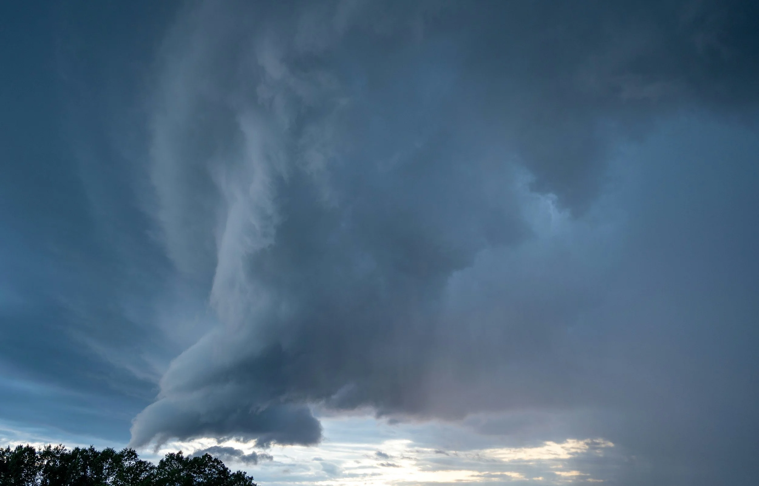
Inside and just ahead of a trough, the air tends to rise. That rising motion happens because the flow aloft is spreading out, this is called divergence. When air rises, it cools and condenses into clouds and precipitation. That’s why troughs are often associated with cloudy, unsettled, or stormy weather.
If you were to stand on the ground beneath a deep trough, you’d probably notice cooler temperatures, lower pressure, and a general storm system feel; gusty winds, gray skies, and maybe precipitation moving through. It’s where the atmosphere is constantly mixing and changing.
What About a Ridge?
A ridge is the opposite of a trough; it’s an area of high pressure aloft. It is shown on a 500 mb map as a northward bulge in the contours. It resembles a mountain in the atmospheric flow.
In a ridge, the air above you is generally sinking. This sinking air compresses and warms as it descends, which tends to dry out the atmosphere and suppress cloud formation. That’s why ridges bring sunny skies, warmer temperatures, and calmer conditions.
If you’ve ever experienced a long stretch of warm, dry weather in summer, or an unseasonable winter warm up, you were probably sitting under a ridge.
Strong ridges can even cause heat waves if they stay parked over one region for too long. This is because warm air is trapped near the surface.
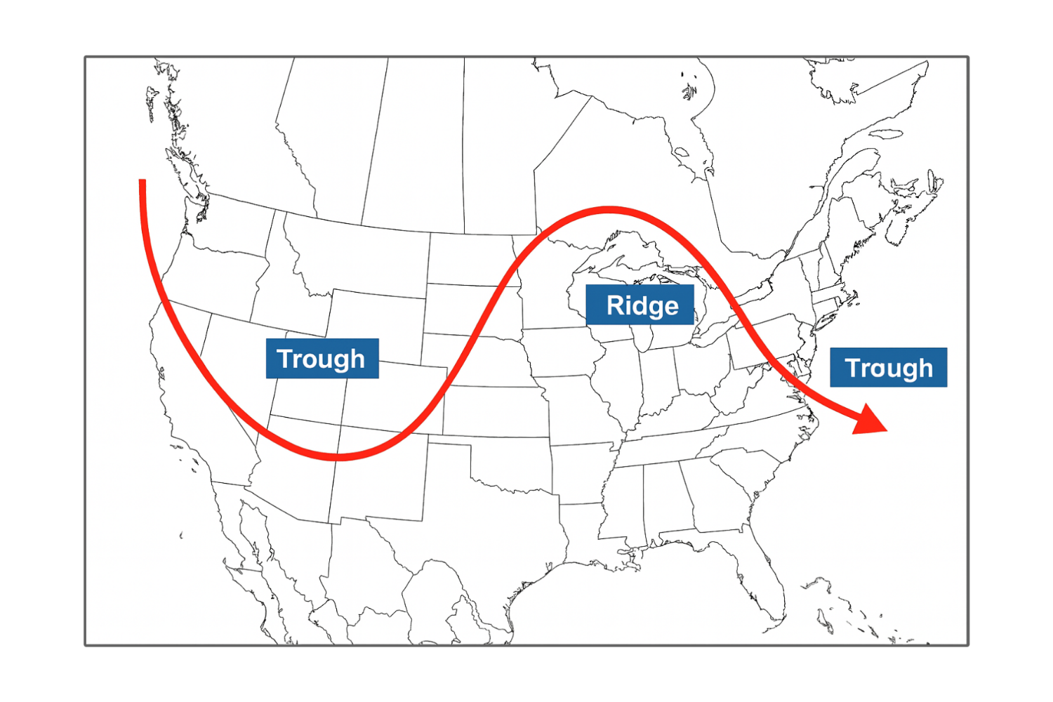
Simplified illustration of upper - air flow showing a ridge over the central U.S. and troughs to the east and west.
Image created for educational use by The Wx Learner.
The Science Behind the Waves
Why does the jet stream bend and twist into troughs and ridges instead of staying straight? The answer comes down to temperature differences, the Earth’s rotation, and the energy in the atmosphere.
The jet stream exists because of the contrast between cold polar air and warm tropical air. Where those air masses meet, strong pressure gradients form and that’s what drives the jet stream. But those gradients aren’t uniform across the globe, so the jet stream starts to meander, forming waves that move west to east.
These planetary-scale waves are called Rossby waves, and they’re the reason troughs and ridges exist. Where the wave dips southward, you get a trough, colder air moving south. Where it bulges northward, you get a ridge
When you add the Coriolis effect, which is caused by Earth’s rotation, along with the influence of mountains, coastlines, and ocean temperature contrasts, you get a constantly shifting, wavy river of air that rarely flows in a straight line.
Troughs and Ridges in Action
To see how these features shape weather, let’s take a real-world example. Suppose a trough is digging into the western United States while a ridge is building in the East.
In the West, air is rising ahead of the trough. Surface low pressure forms, storms develop, and temperatures drop.
In the East, the ridge encourages sinking air, suppresses clouds, and pumps in warmth from the south.
Due to this, rain and mountain snow form in California and the Rockies, while the southeast has sunshine and warm temperatures.
A week later, that same wave pattern may shift eastward. The stormy weather follows the trough, and the ridge moves off the coast. The East cools down and the West dries out. The jet stream steers our weather systems.
Why Troughs and Ridges Matter for Forecasting
For meteorologists, tracking the position and strength of troughs and ridges is crucial. They determine not only the current weather, but also where fronts and storms form - and where temperatures will rise or fall.
Short-term forecasting focuses on smaller-scale ripples in the jet stream, called shortwaves, that deepen troughs or amplify ridges. When a shortwave passes through a trough, it can trigger thunderstorms or severe weather outbreaks. When one moves into a ridge, it can flatten it and shift the pattern eastward.
Long-term forecasting, meanwhile, looks for persistent or blocking patterns. For example, when a strong ridge parks over the western U.S. for weeks, the East often ends up under a repeated trough pattern, leading to cooler, wetter conditions there. These large-scale patterns can lock in for days or even months.
The Push and Pull of the Atmosphere
Troughs and ridges are constantly interacting. When one deepens, the other often amplifies downstream. That’s because the atmosphere wants to stay in balance. Energy moving through a trough tends to feed the ridge downstream, which is why you’ll often hear meteorologists say, “As the western trough deepens, the eastern ridge amplifies.”
When the jet stream speeds up, those waves flatten out. That means fewer extremes, more zonal (west-to-east) flow, and milder day-to-day changes.
When the jet stream slows down, the waves grow larger and more amplified. This is when we get big temperature swings, strong storms, and stubborn weather patterns.
When Troughs and Ridges Get Stuck
Sometimes, the pattern stops moving. This is called a blocking pattern, and it can cause serious weather problems.
If a ridge stalls, it can lead to droughts or heat waves, since there’s no rising motion or rain to break the pattern.
If a trough stalls, it can cause prolonged cold and wet periods, even flooding, because systems keep regenerating in the same area.
One of the most common types is the Omega Block, named because the jet stream takes on the shape of the Greek letter Ω , this is a ridge flanked by two troughs. These can linger for a week or more, locking in one region’s weather while another experiences the opposite.
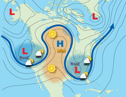
An omega block pattern; a ridge of high pressure forms between two troughs, creating a jet stream shaped like Ω and locking the weather systems in place.
Image used for educational purposes.
Source: NOAA.
How You Can Spot Them
You don’t need to be a professional forecaster to start recognizing these patterns.
Look at a 500 mb map and you’ll see contour lines looping north and south, those loops are troughs and ridges.
Try comparing those maps to the weather outside. You’ll start to notice that when your area is under a ridge, skies are clear and temperatures rise. When a trough moves in the conditions quickly turn unsettled.
Final Thoughts
Troughs and ridges are the heartbeat of our atmosphere. They drive the weather we see every day. They remind us that the sky is alive, breathing and constantly balancing the temperature and motion of the air.
When I first started studying meteorology, the lines on a weather map didn’t make any sense to me. But once I realized they showed rising and sinking air, it all clicked for me.
So next time you hear a meteorologist mention “a trough digging into the Midwest” or “a ridge building over the Southeast,” you’ll know what they mean.
And who knows, maybe you’ll start spotting them, too.
If you’re just starting to learn how the atmosphere works, stick around — we’ll keep exploring how these patterns come together and shape the weather we see every day.